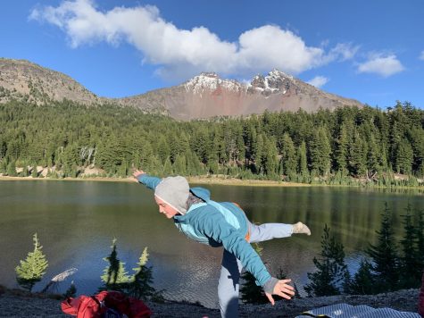
Trails to hike, climb near Linfield
October 1, 2015
Drift creek falls:
Difficulty: Moderate
Distance: 3 miles in and out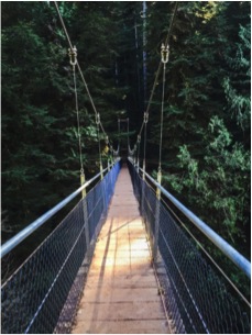
Elevation Gain: 490 ft.
Best times to go: year round
How far away from campus: 1 hour and 24 minutes, just outside of Lincoln City
The 50 year old regrowth forest shows a healthy Coast Range Forest, the trial is well maintained and has a distinctly unique feature. Beyond the upper ridge a 75 ft. suspension bridge hangs over the creek that the trail follows down to the falls, the bridge crosses over drift creek canyon, where the falls can be seen from the bridge.
Abiqua Falls
Distance: 0.8 miles in and out
Elevation gain: 180 ft.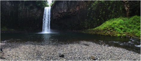
Difficulty: Moderate (trail is a bit rough)
Best time to go: year round
How far off campus: 1 hour and 36 minutes, near Silverton
The falls is part of the geological formation of waterfalls at Silver Falls State Park, the free falling waterfall of over 92 ft. is centered on basaltic bedrock with an array of different species of moss and lichen encompassing the waterfall. The road to the trail head is gravel with a lot of potholes, a very heavy duty passenger car or preferably a truck is needed to get to the trailhead.
Opal Creek
Distance: 7 mile loop, or 2-3 mile in and out
Elevation gain: 1900 ft.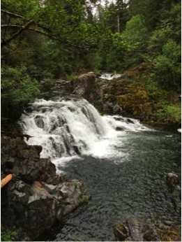
Difficulty: easy to moderate
Best time to go: April through October (snow dependent) but open all year
How far off campus: 1 hour 33 minutes outside of Salem
Opal creek forest is one of the oldest forests in the Pacific Northwest, with over 36 miles of trails which are the remnants of old fire and logging routs, much of it can be seen. The main trail is a 7 mile loop with cabins at the center of it which can be rented by reservation only.
Silver Falls
Distance: 8.7 mile loop
Elevation gain: 1300 ft.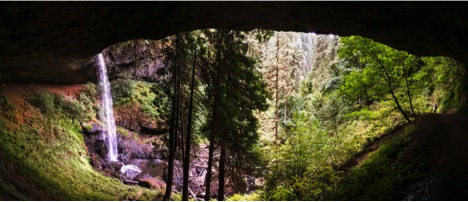
Difficulty: moderate
Best time to go: Spring but open year round
How far off campus: 1 hour and 17 minutes
Silver falls is one of the more popular and more well-known hikes in Oregon and the Pacific Northwest. It’s a series of waterfalls throughout 9,000 acres of some of America’s most impressive waterfalls, and canyons. Majority of the hike is family friendly, with camping and lodging by reservation only.
Cascade Head:
Distance: 6.8 miles in and out
Elevation gain: 1331 ft.
Difficulty: moderate 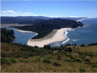
Best time to go: all year (closed Jan 1-Jul15)
How far off campus: 1 hour and 2 minutes
Cascade Head is the tip of a 300-mile-long Columbia River basalt lava flow that erupted about 15 million years ago and dabbled up at the seashore here. Cascade Head is actually 3 trail heads, with meadow viewpoints and the “big” viewpoint which is the view of the ocean. The trail crosses several small streams and bridges which eventually leads to the big view point where many miles of coastline can be seen.
Valley of the Giants Loop Hike
Difficulty: easy
Distance: 1.4 miles loop
Elevation gain: 1335 ft.
Best times to go: Spring/ summer
How far away from campus: 1 hour and 32 minutes
Located on the Western edge of the Polk county The Bureau of Land and Management has protected 51 acres of old growth forest on the north fork of the Siletz River, just for recreational hiking purposes. Douglas Firs and Western Hemlocks are around 500 years old in this protected section of the forest and can be seen on the hike. Roads to get to the trail head are hard packed gravel with lots of potholes, a sturdy passenger car or truck is preferred.